
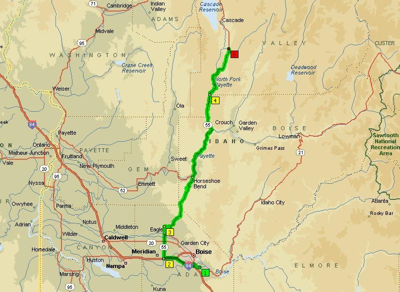
Map of the Smith's Ferry Breakfast Ride from Boise via Eagle, Horseshoe Bend, and Banks. After stopping at the North Fork Payette River Bridge above Smith's Ferry, we returned to Boise using same route.
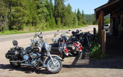
Outside Cougar Mountain Lodge facing Hwy 55 from the east in Smith's Ferry are six sleds from the Boise Valley Riders Club. Hwy 55 is otherwise known as the Payette River Scenic Byway, and runs about 112 miles from Eagle to New Meadows.
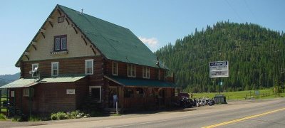
View of Cougar Mountain Lodge by Hwy 55 from the west where we stopped for breakfast before continuing up to the North Fork Payette River Bridge also known as the Rainbow Bridge.

Back of Cougar Mountain Lodge looks as if came straight out of Switzerland. Directly behind the patio doors are the informal dining room and cafe where we grabbed breakfast.

Right behind the Cougar Mountain Lodge is this small bridge spanning a narrow part of the North Fork Payette River. Rafting outfits put into the river just to the right of bridge where there's a small parking area.
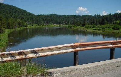
Facing north, the North Fork Payette River as seen from bridge in previous photo. This location is 17 miles south from the town of Cascade. No rapids up here, but there's plenty of them downriver.
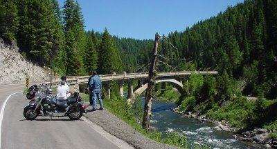
Just a few minutes north of Smith's Ferry is the North Fork Payette River Bridge which was built in 1933, and spans 410' from southwest to northeast Hwy 55. Several Boise Valley Riders stopped here for awhile.

Another view of the North Fork Payette River Bridge (facing south). We followed the winding, two-lane Hwy 55 alongside the Payette River back to Eagle where we had cold ones on the patio at
River Rock Alehouse before calling it a day.
 Map of the Smith's Ferry Breakfast Ride from Boise via Eagle, Horseshoe Bend, and Banks. After stopping at the North Fork Payette River Bridge above Smith's Ferry, we returned to Boise using same route.
 Outside Cougar Mountain Lodge facing Hwy 55 from the east in Smith's Ferry are six sleds from the Boise Valley Riders Club. Hwy 55 is otherwise known as the Payette River Scenic Byway, and runs about 112 miles from Eagle to New Meadows.
 View of Cougar Mountain Lodge by Hwy 55 from the west where we stopped for breakfast before continuing up to the North Fork Payette River Bridge also known as the Rainbow Bridge.
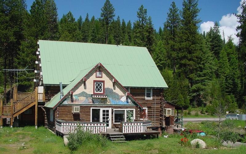 Back of Cougar Mountain Lodge looks as if came straight out of Switzerland. Directly behind the patio doors are the informal dining room and cafe where we grabbed breakfast.
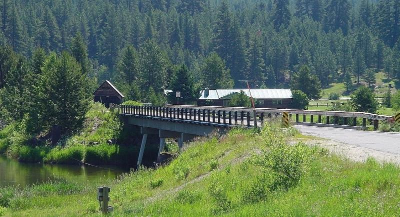 Right behind the Cougar Mountain Lodge is this small bridge spanning a narrow part of the North Fork Payette River. Rafting outfits put into the river just to the right of bridge where there's a small parking area.
 Facing north, the North Fork Payette River as seen from bridge in previous photo. This location is 17 miles south from the town of Cascade. No rapids up here, but there's plenty of them downriver.
 Just a few minutes north of Smith's Ferry is the North Fork Payette River Bridge which was built in 1933, and spans 410' from southwest to northeast Hwy 55. Several Boise Valley Riders stopped here for awhile.
 Another view of the North Fork Payette River Bridge (facing south). We followed the winding, two-lane Hwy 55 alongside the Payette River back to Eagle where we had cold ones on the patio at River Rock Alehouse before calling it a day.
No comments:
Post a Comment